
ESGine
ESG data infrastructure for municipalities.
ESGine helps municipalities organize sustainability, emissions, environmental, and climate-related data in one structured platform.
Built for local authorities OTA1-OTA2 in Greece, ESGine platform supports the digitalization of ΔηΣΜΕ making a clearer reporting, better understanding for the targets, internal coordination in between the departments, and stronger environmental accountability.

Municipal reporting starts with structured data.
Municipalities are expected to manage more environmental information than ever before: emissions, sustainability actions, climate projects, environmental documentation, and progress indicators. Especially the reporting of ΔηΣΜΕ demands accuracy and continues monitoring and annually reporting that ESGine can deliver easily to the municipalities avoiding time waste and effort.
When that information is scattered across departments, files, and reports, decision-making becomes slower and accountability becomes harder.
ESGine gives municipalities a structured data layer for environmental management and ESG reporting, data that can function as a strategic enabler for securing funding, particularly through European and other national public financing mechanisms.The question is how to plant with the speed, accuracy, and structure each project needs.
Built for municipal environmental data.
ESGine supports the collection, organization, and use of ESG and environmental information across municipal operations.
Key capabilities:
Municipal ESG
data collection
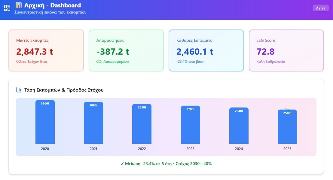
Emissions data organization
Climate and sustainability
project tracking
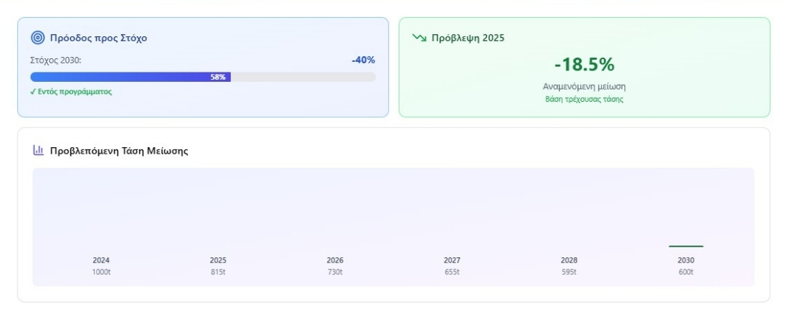
Environmental record management
Audit proof
ΔηΣΜΕ and ΣΕΑΚ data reporting preparation
Evidence management
Progress monitoring
Department-level access
ISO37120 tracking and analysis
Multilingual and accessible
One system for different planting needs.
Green’s Gaia supports:
Built for scale.
Each Green’s Gaia production line can plant up to:
1 tree every
15 seconds
8 trees
per minute
1.5 hectares
in 8 hours
Every tree has a record.
The unique location of each tree or sapling is recorded in the Green’s Gaia database.
This creates a clear digital record of:
This is the key difference:
Green’s Gaia can show what was planted, where it was planted, and how the project can be followed over time.
More than planting.
A complete field execution system.
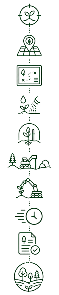
Precision planting
Tree geolocation mapping
Digital planting plans
Watering and fertilization during planting
Sapling endurance and early growth support
Operation across varied terrain and field conditions
Robotic planting technology
Faster planting workflows
Long-term project documentation
Complete restoration or cultivation planning

Designed around environmental responsibility and long-term value.
Green’s Gaia is committed to planting projects that are planned carefully, executed responsibly, and documented clearly.